
How Drone Mapping Supports Targeted Input Reduction on Farms
Reducing fertiliser, water and spray use without compromising yield is a priority for many farms and estates. Rising costs, environmental pressure and regulatory scrutiny have made blanket application increasingly difficult to justify.
Drone mapping is often presented as a way to address this challenge. Used carefully, it can support more targeted decisions. Used carelessly, it can add complexity without benefit.
This article explains how drone mapping supports targeted input reduction on farms - and where its limits remain.
What Targeted Input Reduction Means in Agriculture
Targeted input reduction is not about doing less everywhere. It is about applying the right level of input, in the right place, at the right time.
Most fields are not uniform. Soil structure, drainage, historic use and microclimate all contribute to variability. Treating these areas as if they behave identically often leads to over-application in some zones and under-performance in others.
Drone mapping helps make that variability visible.
How Drone Mapping Identifies Variability Across Fields
Aerial surveys allow land managers to see patterns that are difficult to detect at ground level. Variations in crop vigour, stress and development often appear clearly when viewed from above.
When carried out consistently, drone mapping can help identify:
Areas of persistent under- or over-performance
Zones affected by compaction, waterlogging or uneven establishment
Differences in crop response across a single field
These insights help prioritise attention. They do not, on their own, explain the cause - but they do narrow the focus.
Where Aerial Data Supports Input Reduction
Drone mapping is most useful when it informs where intervention may be adjusted, rather than dictating how much input should be applied.
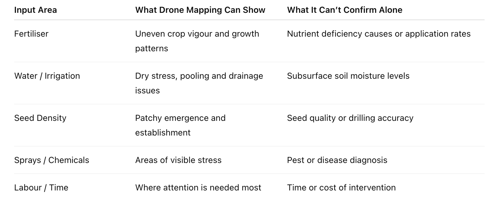
Drone Logistics - Agricultural Drone Mapping: Input Vs Output
Drone data highlights variability. Interpretation and adjustment remain human-led.
From Data to Decision: A Practical Process
Aerial survey identifies visible variability
Ground checks confirm likely causes
Inputs are adjusted only where evidence supports it
Yield is protected through targeted action
The technology does not remove steps. It helps prioritise them.
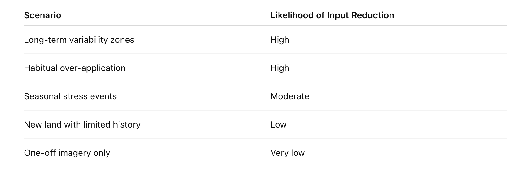
Where Input Reduction Is Most Realistic
Where Drone Mapping Has Clear Limits
Drone mapping does not explain why a problem exists. It does not replace agronomic judgement, local knowledge or experience of the land.
Common misconceptions include:
That one survey is enough to change strategy
That aerial data removes uncertainty
That technology replaces decision-making
In practice, yield loss is more often caused by overconfidence than by a lack of data.
Using Drone Data Responsibly on Farms
Comparing data over time rather than relying on single surveys
Timing surveys consistently
Verifying findings on the ground
Making conservative adjustments
A Tool to Support Better Farming Decisions
Drone mapping is not a shortcut to lower costs. It is a tool that helps farms understand variability more clearly and respond more proportionately.
Used responsibly, it can support targeted input reduction while protecting yield. Used indiscriminately, it risks replacing one form of guesswork with another.
A short scoping conversation can help clarify whether aerial data would meaningfully support your land management decisions.